-
Featured Global Power Plant Database
The Global Power Plant Database is a comprehensive, open source database of power plants around the world. It centralizes power plant data to make it easier to navigate, compare and draw insights for one’s own analysis. The database covers approximately 35,000 power plants from 167 countries and...
-
Aqueduct Global Maps 2.0
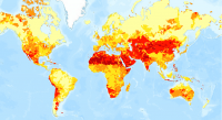
Companies can use this information to prioritize actions, investors to leverage financial interest to improve water management, and governments to engage with the private sector to seek solutions for more equitable and sustainable water governance. Aqueduct Global Maps 2.0 includes indicators of...
-
Featured Aqueduct Global Flood Risk Maps
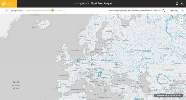
For the current scenario, we used hydrological data from 1960 through 1999 for generating flood inundations for 9 return periods, from 2-year flood to 1000-year flood, and 2010 GDP, population, and land use data for assessing flood impacts. For future projections, we used 5 GCMs (Global Climate...
-
Featured Aqueduct Global Maps 2.1 Data
Awareness around the physical, regulatory, and reputational water risks to companies and their investors is on the rise and robust, comparable and comprehensive data is needed to help assess these water-related risks. In response to this demand, the World Resources Institute developed the...
-
Aqueduct Global Flood Risk Country Rankings
Key Findings Approximately, 21 million people worldwide could be affected by river floods on average each year, and the 15 countries with the most people exposed, including India, Bangladesh, China, Vietnam, Pakistan, Indonesia, Egypt, Myanmar, Afghanistan, Nigeria, Brazil, Thailand, Democratic...
-
Global Map of Threat of Blast or Poison Fishing
This dataset was used as base data in Reefs at Risk. Map of blast and poison fishing (1 km grid) was developed for use in the Reefs at Risk Revisited project as a component of the model of overfishing and destructive fishing pressure on coral reefs. This layer designates threat of blast and...
-
City-scale climate hazards at 1.5°C, 2.0°C, and 3.0°C of global warming
Global climate models can provide valuable information to city decision makers for strategic planning, climate adaptation, risk management, and budgeting—but it can be difficult to glean from these models information that is directly suited to city scales and city problems. This dataset contains...
-
Romania tree cover
Retrieved from Global tree cover loss data from GFW. Displays tree cover loss in the country from 2001 to 2013, represented by pixel values 1-13, respectively.
-
Featured Intact Forest Landscapes (2013)
"The Intact Forest Landscapes (IFL) data set identifies unbroken expanses of natural ecosystems within the zone of forest extent that show no signs of significant human activity and are large enough that all native biodiversity, including viable populations of wide-ranging species, could be...
-
Reefs at Risk Revisited: Climate-Related Threats Data
Global (i.e., climate-related) threats to the world's coral reefs were analyzed. These include: past thermal stress (i.e., warming seas and bleaching over the last decade), future thermal stress (ie., projections of future warming in 2030 and 2050); and ocean acidification (i.e., reduced ocean...
-
Shipping Activity
This dataset was used as base data in Reefs at Risk. Shipping activity data used in the model of threat to coral reefs from marine-based pollution and damage in the Reefs at Risk Revisited project. This dataset was derived at WRI from the World Meteorological Organization Voluntary Observing...
-
Featured RSPO Palm Oil Mills
Certification of sustainable palm oil production is handled through the palm oil mill and its supply base. The certification includes plantations managed by the mill and plantations managed by other suppliers, including smallholders. To have its oil mill certified, a palm oil producer must show a...
-
Featured Archive fires for Indonesia
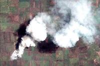
The Fire Information for Resource Management System (FIRMS) delivers global MODIS-derived hotspots and fire locations. The active fire locations represent the center of a 1-kilometer pixel that is flagged by the MOD14/MYD14 Fire and Thermal Anomalies Algorithm as containing one or more fires...
-
Digital Globe GEO1 Satellite Imagery
Effective emergency planning and response requires quick and easy access to accurate, up-to-date information. DigitalGlobe’s FirstLook is an online subscription service for emergency management that provides fast web-based access to pre-and post-event imagery of world disasters delivered to...
-
Digital Globe QB01 Satellite Imagery
Effective emergency planning and response requires quick and easy access to accurate, up-to-date information. DigitalGlobe’s FirstLook is an online subscription service for emergency management that provides fast web-based access to pre-and post-event imagery of world disasters delivered to...
-
Sarawak oil palm concessions
This data set provides the boundaries of known oil palm concessions for the state of Sarawak, Malaysia, and was compiled from available public documents. Where available, associated information provided with this data set includes licensee name, permit number (Operational Ticket), corporate...
-
Reefs at Risk Revisited (Local Threats Data)
Threats from coastal development, marine-based pollution and damage, overfishing and destructive fishing, and watershed-based pollution were analyzed separately. These threats were integrated into the Integrated Local Threat index. Past thermal stress was integrated with local threats into the...
-
WRI Ross Center for Sustainable Cities’ Water and Sanitation 15-City Study
To address the absence of comparable city-level water data, this dataset compiles data from 15 global South cities located in sub-Saharan Africa, South Asia, and Latin America and among the regions that are the focus of the World Resources Report (WRR) "Towards a More Equal City". The 15 cities...
-
Digital Globe WV01 Satellite Imagery
Effective emergency planning and response requires quick and easy access to accurate, up-to-date information. DigitalGlobe’s FirstLook is an online subscription service for emergency management that provides fast web-based access to pre-and post-event imagery of world disasters delivered to...
-
Bleaching observations (1963-2010)
This dataset was used as base data in Reefs at Risk. Point locations of reported observations of coral bleaching between 1963 and 2010. This dataset was built upon an original bleaching database developed at UNEP-WCMC, and has been maintained and updated regularly by ReefBase since early 2002.
