-
World's Average Monthly Rainfall in November
This data was used in Map 3.5 in Nature's Benefits in Kenya: An Atlas of Ecosystems and Human Well-Being.
-
World's Average Monthly Rainfall in July
This data was used in Map 3.4 in Nature's Benefits in Kenya: An Atlas of Ecosystems and Human Well-Being.
-
World's Average Monthly Rainfall in April
This data was used in Map 3.3 in Nature's Benefits in Kenya: An Atlas of Ecosystems and Human Well-Being.
-
World's average monthly rainfall in February
This data was used in Map 3.2 in Nature's Benefits in Kenya: An Atlas of Ecosystems and Human Well-Being.
-
CAIT - Country Clean Technology Data
This collection emerges from a collaboration of five leading research institutions: World Resources Institute (WRI), Institute for Global Environmental Strategies (IGES), Öko Institut, Renmin University, and The Energy and Resources Institute (TERI), based in the target countries. Researchers at...
-
Eutrophication & Hypoxia Map Data Set
The Interactive Map of Eutrophication & Hypoxia represents 762 coastal areas impacted by eutrophication and/or hypoxia. There are 479 sites identified as experiencing hypoxia, 55 sites that once experienced hypoxia but are now improving, and 228 sites that experience other symptoms of...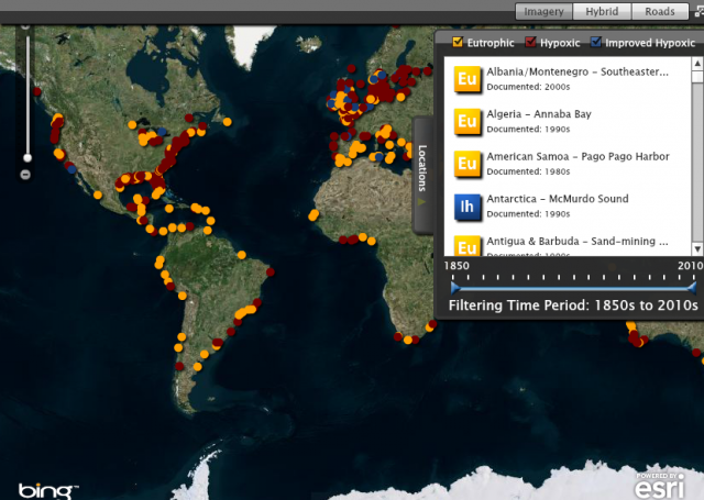
-
Climate Vulnerable Forum Mapping of Opportunities
This data maps opportunities for Climate Vulnerable Forum countries to enhance their Nationally Determined Contribution by 2020.
-
Supplementary Materials for "State of the Nationally Determined Contributions...
This dataset presents information on the adaptation components of 86 countries’ NDCs submitted until June 30, 2021, in association with the working paper State of the Nationally Determined Contributions: Enhancing Adaptation Ambition. Nine NAPs submitted by the 86 countries during this time frame...
-
Climate Watch Pathways (previously CAIT - Emissions Projections)
The CAIT Projections module was made available in 2015 and provided ready access to emission projections for major emitters through the year 2100 (if data is available). All data is now available on Climate Watch. In addition to providing emissions data, this tool aims to increase the...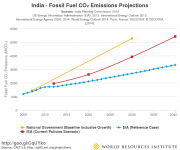
-
Climate Watch (CAIT) - Country Greenhouse Gas Emissions Data
The dataset applies a consistent methodology to create a six-gas, multi-sector, and internationally comparable data set for 197 countries. It enables data analysis by allowing users to quickly narrow down by year, gas, country/state, and sector. Automatic calculations for percent changes from...
-
China Overseas Finance Inventory Database
The COFI database includes power-generation projects in Belt and Road Initiative (BRI) countries financed by Chinese corporations and banks that reached financial closure from 2000 to 2023. Types of financing include debt and equity investment, with the latter including greenfield foreign direct...
-
Fast-Start Finance Contributions
This workbook contains data from a detailed review of the 2010-2012 fast-start finance (FSF) contributions of five countries reporting the largest FSF contributions (Germany, Japan, Norway, the UK, and the USA) and from a supplemental review of the remaining FSF contributions from 31 additional...
-
Tropical Coral Reefs of the World (500-m resolution grid)
Global map of shallow, tropical coral reefs, gridded at 500-m resolution for use in the Reefs at Risk Revisited project. The coral reef location data were compiled from multiple sources by UNEP-WCMC, the WorldFish Center, and WRI. To standardize these data for the purposes of the Reefs at Risk...
-
Climate Watch (CAIT) - UNFCCC Annex I GHG Emissions Data
The CAIT Paris Contributions Map was made available in 2014 to enables users to explore, compare, and assess countries climate committments in each country's Intended Nationally Determined Contributions (INDC). Countries are not submitting and updating their national climate committments through...
-
Featured Climate Watch – Nationally Determined Contributions (NDC) Data (previously CA...
The CAIT Paris Contributions Map was made available in 2014 to enables users to explore, compare, and assess countries climate commitments in each country's Intended Nationally Determined Contributions (INDC). Countries are not submitting and updating their national climate commitments through...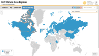
-
Waterbodies in Uganda
This dataset results from the combination of three datasets: 1. NATIONAL FOREST AUTHORITY (NFA). 1996. Land Cover GIS Database. Kampala, Uganda: Government of Uganda, NFA. 2. NATIONAL IMAGERY AND MAPPING AGENCY (NIMA). 1997. Vector Map Level 0 (Digital Chart of the World), 3rd Edition....
-
Featured Protected areas
The World Database on Protected Areas (WDPA) is the most comprehensive global spatial data set on marine and terrestrial protected areas available. Protected area data are provided via Protected Planet, the online interface for the World Database on Protected Areas (WDPA). The WDPA is a joint...
-
Marine Protected Areas in Coral Reef Regions of the World
This dataset is part of the base data used for Reefs at Risk Revisited. To assess the level of protection and management for coral reefs around the world. The map of MPAs and associated management effectiveness scores were used to adjust pressure from overfishing and destructive fishing in the...
-
Reefs at Risk Revisited (Social Vulnerability Data)
This shapefile features the Exclusive Economic Zones (EEZs) for 108 coral reef countries and territories classified according to an index of their reef dependence, adaptive capacity, and social vulnerability. Results are presented as quartiles, with 27 countries/territories classified in each of...
-
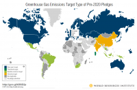
CAIT - Countries' Pre-2020 Climate Pledges submitted to the UNFCCC
The structured data from the CAIT Pre-2020 Pledges Map enables users to explore, compare, and assess climate change mitigation pledges submitted by Parties to the United Nations Framework Convention on Climate Change (UNFCCC) in 2009 and 2010. The information related to quantified economy-wide...