-
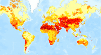
Aqueduct Global Maps 2.0
Companies can use this information to prioritize actions, investors to leverage financial interest to improve water management, and governments to engage with the private sector to seek solutions for more equitable and sustainable water governance. Aqueduct Global Maps 2.0 includes indicators of...
-
Featured Aqueduct Global Maps 2.1 Data
Awareness around the physical, regulatory, and reputational water risks to companies and their investors is on the rise and robust, comparable and comprehensive data is needed to help assess these water-related risks. In response to this demand, the World Resources Institute developed the...
-
Global Map of Threat of Blast or Poison Fishing
This dataset was used as base data in Reefs at Risk. Map of blast and poison fishing (1 km grid) was developed for use in the Reefs at Risk Revisited project as a component of the model of overfishing and destructive fishing pressure on coral reefs. This layer designates threat of blast and...
-
Permanent and Non-Permanent Rivers in Kenya
This data was used in maps featured in Natures Benefits in Kenya: An Atlas of Ecosystems and Human Well-Being. Original data are available at http://mapping.usgs.gov/esic/cdrom/vmap.html.
-
Major Airfields in Kenya
This data was used in Map 6.4 and Map 6.5 featured in Natures Benefits in Kenya: An Atlas of Ecosystems and Human Well-Being.
-
Urban areas in Kenya
This data was used in Map 1.3 and in other maps throughout Nature's Benefits in Kenya: An Atlas of Ecosystems and Human Well-Being. Original data are downloadable at www.africover.org.
-
Locations of sand beaches in Kenya
This data was used in Map 6.4 and Map 6.5 in Nature's Benefits in Kenya: An Atlas of Ecosystems and Human Well-Being. Original data are downloadable at www.africover.org.
-
Forest Types in Kenya, 2000
This data was used in Map 1.3 and Map 7.1 in Nature's Benefits in Kenya: An Atlas of Ecosystems and Human Well-Being. Original data are downloadable at www.africover.org.
-
Population density of Kenya, 1999
This data was used in Map 1.6 and Map 2.5 in Nature's Benefits in Kenya: An Atlas of Ecosystems and Human Well-Being.
-
Wetlands in Kenya
This data was used in selected maps in Nature's Benefits in Kenya: An Atlas of Ecosystems and Human Well-Being. Original data are downloadable at www.africover.org.
-
Savannah and grassland in Kenya
This data was used in Map 1.3 in Nature's Benefits in Kenya: An Atlas of Ecosystems and Human Well-Being. Original data are downloadable at www.africover.org.
-
Floodplains and valley bottoms in Kenya
This data was used in Map 3.14 and Map 3.15 in Nature's Benefits in Kenya: An Atlas of Ecosystems and Human Well-Being. Original data are downloadable at www.africover.org.
-
Coral reefs in Kenya
This data was used in Map 6.4 and Map 6.5 in Nature's Benefits in Kenya: An Atlas of Ecosystems and Human Well-Being. The full report is available at http://www.geus.dk/program-areas/nature-environment/international/reports/kensea/kensea_rapport.pdf.
-
Bare areas (areas naturally devoid of vegetation) in Kenya
This data was used in Map 1.3 in Nature's Benefits in Kenya: An Atlas of Ecosystems and Human Well-Being. Original data are downloadable at www.africover.org.
-
Kenya shaded relief surface (250m resolution)
This data was used in maps throughout Nature's Benefits in Kenya: An Atlas of Ecosystems and Human Well-Being.
-
Kenya Digital Elevation Model (DEM) (250m resolution)
This data was used in maps throughout Nature's Benefits in Kenya: An Atlas of Ecosystems and Human Well-Being.
-
Locations of sable antelope sites, Kenya
This data was used in Map 6.4 and Map 6.5 in Nature's Benefits in Kenya: An Atlas of Ecosystems and Human Well-Being. Original data and report are downloadable at http://www.unep.org/eafatlas/dbke.htm.
-
Potential Grevy's zebra range in Kenya
This data was used in Map 5.13 and Map 5.14 in Nature's Benefits in Kenya: An Atlas of Ecosystems and Human Well-Being. Please refer to DRSRS for updates.
-
Major Roads in Kenya
This data was used in maps throughout Nature's Benefits in Kenya: An Atlas of Ecosystems and Human Well-Being.
-
Number of beds by hotel on the eastern coast of Kenya
Number of beds calculated by ILRI and WRI, based on RoK 2003 and UNEP 1998. This data was used in Map 6.4 and Map 6.5 in Nature's Benefits in Kenya: An Atlas of Ecosystems and Human Well-Being.
