-
Local Government Renewables Action Tracker
The Tracker contains information on two types of renewables activities commonly being pursued by local governments in the United States: 1. Electricity purchases and transactions, such as on-site solar, community solar projects, off-site power purchase agreements (PPAs), and green tariff...
-
Featured Global Power Plant Database
The Global Power Plant Database is a comprehensive, open source database of power plants around the world. It centralizes power plant data to make it easier to navigate, compare and draw insights for one’s own analysis. The database covers approximately 35,000 power plants from 167 countries and...
-
CAIT - Country Clean Technology Data
This collection emerges from a collaboration of five leading research institutions: World Resources Institute (WRI), Institute for Global Environmental Strategies (IGES), Öko Institut, Renmin University, and The Energy and Resources Institute (TERI), based in the target countries. Researchers at...
-
Annual Growth of Biomass and Theoretically Harvestable Biomass Yield outside ...
This data was used in Map 7.6 and Map 7.7 in Nature's Benefits in Kenya: An Atlas of Ecosystems and Human Well-Being. Values of zero for both fields pertain to croplands and urban areas, and should be displayed as ""not applicable."" Note: All areas classified as 'natural and semi-natural' in...
-
Climate Vulnerable Forum Mapping of Opportunities
This data maps opportunities for Climate Vulnerable Forum countries to enhance their Nationally Determined Contribution by 2020.
-
Climate Watch (CAIT) - UNFCCC Annex I GHG Emissions Data
The CAIT Paris Contributions Map was made available in 2014 to enables users to explore, compare, and assess countries climate committments in each country's Intended Nationally Determined Contributions (INDC). Countries are not submitting and updating their national climate committments through...
-
Featured Climate Watch – Nationally Determined Contributions (NDC) Data (previously CA...
The CAIT Paris Contributions Map was made available in 2014 to enables users to explore, compare, and assess countries climate commitments in each country's Intended Nationally Determined Contributions (INDC). Countries are not submitting and updating their national climate commitments through...
-
Sources of wood for charcoal in selected administrative Districts in Kenya, 2004
This data was used in Map 7.5 in Nature's Benefits in Kenya: An Atlas of Ecosystems and Human Well-Being.
-
CAIT - Countries' Pre-2020 Climate Pledges submitted to the UNFCCC
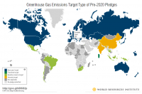
The structured data from the CAIT Pre-2020 Pledges Map enables users to explore, compare, and assess climate change mitigation pledges submitted by Parties to the United Nations Framework Convention on Climate Change (UNFCCC) in 2009 and 2010. The information related to quantified economy-wide...
-
Climate Watch (CAIT) - Country Greenhouse Gas Emissions Data
The dataset applies a consistent methodology to create a six-gas, multi-sector, and internationally comparable data set for 197 countries. It enables data analysis by allowing users to quickly narrow down by year, gas, country/state, and sector. Automatic calculations for percent changes from...
-
China Overseas Finance Inventory Database
The COFI database includes power-generation projects in Belt and Road Initiative (BRI) countries financed by Chinese corporations and banks that reached financial closure from 2000 to 2023. Types of financing include debt and equity investment, with the latter including greenfield foreign direct...
-
Locations of proposed small micro-hydropower sites in Kenya
Locations of micro-hydro sites approximately located by WRI based on SoK 1971, and information from ITDG and ESDA 2005. This data was used in Map 3.11 in Nature's Benefits in Kenya: An Atlas of Ecosystems and Human Well-Being.
-
City-scale climate hazards at 1.5°C, 2.0°C, and 3.0°C of global warming
Global climate models can provide valuable information to city decision makers for strategic planning, climate adaptation, risk management, and budgeting—but it can be difficult to glean from these models information that is directly suited to city scales and city problems. This dataset contains...
