-
Spatial distribution of observed elephant numbers in Kenya, 1994-1996
This data was used in Map 6.2 in Nature's Benefits in Kenya: An Atlas of Ecosystems and Human Well-Being. Wildlife counts come from a rangeland census using low-altitude flights in Kenya. Numbers of animals observed were aggregated to 5km grid cells. Note: A number of elephants nul should be...
-
Spatial distribution of observed buffalo numbers in Kenya, 1994-1996.
This data was used in Map 6.2 in Nature's Benefits in Kenya: An Atlas of Ecosystems and Human Well-Being. Wildlife counts come from a rangeland census using low-altitude flights in Kenya. Numbers of animals observed were aggregated to 5km grid cells. Note: A number of buffalo nul should be...
-
Livestock density in Kenya's rangelands, 1994-1996
This data was used in Map 1.5 and Map 4.7 in Nature's Benefits in Kenya: An Atlas of Ecosystems and Human Well-Being. Species numbers are aggregated using a ""tropical livestock unit"" (TLU) (which is equivalent to an animal weight of 250 kilograms) to grid cells of 5x5 km and then averaged by...
-
Locations of mangroves in Kenya (line)
This data was used in Map 6.4 and Map 6.5 in Nature's Benefits in Kenya: An Atlas of Ecosystems and Human Well-Being. The full report is available at http://www.geus.dk/program-areas/nature-environment/international/reports/kensea/kensea_rapport.pdf.
-
Locations of mangroves in Kenya (polygon)
This data was used in Map 6.4 and Map 6.5 in Nature's Benefits in Kenya: An Atlas of Ecosystems and Human Well-Being. The full report is available at http://www.geus.dk/program-areas/nature-environment/international/reports/kensea/kensea_rapport.pdf.
-
Turtle nesting and breeding sites in Kenya
This data was used in Map 6.4 and Map 6.5 in Nature's Benefits in Kenya: An Atlas of Ecosystems and Human Well-Being. The full report is available at http://www.geus.dk/program-areas/nature-environment/international/reports/kensea/kensea_rapport.pdf.
-
Potential Grevy's zebra range in Kenya
This data was used in Map 5.13 and Map 5.14 in Nature's Benefits in Kenya: An Atlas of Ecosystems and Human Well-Being. Please refer to DRSRS for updates.
-
Locations of water supplies serving Nairobi, Kenya.
Locations of dam were approximately located by WRI based on SoK 1971, MoWD and JICA 1992a, 1992b, 1992c, Nyaoro 1999, and Wambua 2003. This data was used in Map 3.9 in Nature's Benefits in Kenya: An Atlas of Ecosystems and Human Well-Being.
-
WRI Ross Center for Sustainable Cities’ Water and Sanitation 15-City Study
To address the absence of comparable city-level water data, this dataset compiles data from 15 global South cities located in sub-Saharan Africa, South Asia, and Latin America and among the regions that are the focus of the World Resources Report (WRR) "Towards a More Equal City". The 15 cities...
-
Locations of sable antelope sites, Kenya
This data was used in Map 6.4 and Map 6.5 in Nature's Benefits in Kenya: An Atlas of Ecosystems and Human Well-Being. Original data and report are downloadable at http://www.unep.org/eafatlas/dbke.htm.
-
Climate Vulnerable Forum Mapping of Opportunities
This data maps opportunities for Climate Vulnerable Forum countries to enhance their Nationally Determined Contribution by 2020.
-
Average water consumption of livestock and wildlife by sub-basin in Kenya, 19...
WRI/ILRI calculation based on animal data from DRSRS 2003; Grunblatt et al. 1995, 1996; and daily water requirements for selected species from MoWD and JICA 1992, Peden at al. 2003, 2004. This data was used in Map 3.13 in Nature's Benefits in Kenya: An Atlas of Ecosystems and Human Well-Being.
-
Grevy's zebra population in Kenya, 1994-96
This data was used in Map 5.14 in Nature's Benefits in Kenya: An Atlas of Ecosystems and Human Well-Being. Census counts of observed numbers of Grevy's Zebra during low-altitude flights, aggregated to 5km grid cells. Please refer to DRSRS for updates.
-
Grevy's Zebra Population in Kenya, 1977-78
This data was used in Map 5.13 in Nature's Benefits in Kenya: An Atlas of Ecosystems and Human Well-Being. Census counts of observed numbers of Grevy's Zebra during low-altitude flights, aggregated to 5km grid cells. Please refer to DRSRS for updates.
-
Bleaching observations (1963-2010)
This dataset was used as base data in Reefs at Risk. Point locations of reported observations of coral bleaching between 1963 and 2010. This dataset was built upon an original bleaching database developed at UNEP-WCMC, and has been maintained and updated regularly by ReefBase since early 2002.
-
Dugong Sites and Dolphin Schools on the Eastern Coast of Kenya
This data was used in Map 6.4 and Map 6.5 in Nature's Benefits in Kenya: An Atlas of Ecosystems and Human Well-Being. Original report and data available on http://www.unep.org/eafatlas/dbke.htm
-
Milk Production Per Square Kilometer in Kenya, 1997
This data was used in Map 4.5 in Nature's Benefits in Kenya: An Atlas of Ecosystems and Human Well-Being.
-
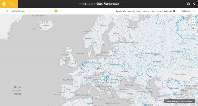
Featured Aqueduct Global Flood Risk Maps
For the current scenario, we used hydrological data from 1960 through 1999 for generating flood inundations for 9 return periods, from 2-year flood to 1000-year flood, and 2010 GDP, population, and land use data for assessing flood impacts. For future projections, we used 5 GCMs (Global Climate...
-
CAIT Indonesia Climate Data Explorer (PINDAI) Data
The data set draws primarily from Local Action Plan for Greenhouse Gas Emission Reduction (RAD GRK), and Medium Term Local Development Plans (RPJMD) of each province in Indonesia. These documents are obtained from Indonesian national and regional government agencies, including the Secretariat of...
-
Annual Growth of Biomass and Theoretically Harvestable Biomass Yield outside ...
This data was used in Map 7.6 and Map 7.7 in Nature's Benefits in Kenya: An Atlas of Ecosystems and Human Well-Being. Values of zero for both fields pertain to croplands and urban areas, and should be displayed as ""not applicable."" Note: All areas classified as 'natural and semi-natural' in...
