-
Featured Archive fires for Indonesia
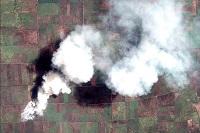
The Fire Information for Resource Management System (FIRMS) delivers global MODIS-derived hotspots and fire locations. The active fire locations represent the center of a 1-kilometer pixel that is flagged by the MOD14/MYD14 Fire and Thermal Anomalies Algorithm as containing one or more fires...
-
Featured Rights to Resources
The data included in this spreadsheet were downloaded from the World Resource Institute's Rights to Resources interactive map. The Rights to Resources interactive map presents the results of a legal review of national laws in sub-Saharan Africa in their treatment of local-use rights to natural...
-
Digital Globe GEO1 Satellite Imagery
Effective emergency planning and response requires quick and easy access to accurate, up-to-date information. DigitalGlobe’s FirstLook is an online subscription service for emergency management that provides fast web-based access to pre-and post-event imagery of world disasters delivered to...
-
Digital Globe WV01 Satellite Imagery
Effective emergency planning and response requires quick and easy access to accurate, up-to-date information. DigitalGlobe’s FirstLook is an online subscription service for emergency management that provides fast web-based access to pre-and post-event imagery of world disasters delivered to...
-
Digital Globe QB01 Satellite Imagery
Effective emergency planning and response requires quick and easy access to accurate, up-to-date information. DigitalGlobe’s FirstLook is an online subscription service for emergency management that provides fast web-based access to pre-and post-event imagery of world disasters delivered to...
-
Featured Protected areas
The World Database on Protected Areas (WDPA) is the most comprehensive global spatial data set on marine and terrestrial protected areas available. Protected area data are provided via Protected Planet, the online interface for the World Database on Protected Areas (WDPA). The WDPA is a joint...
-
Romania tree cover
Retrieved from Global tree cover loss data from GFW. Displays tree cover loss in the country from 2001 to 2013, represented by pixel values 1-13, respectively.
-
Indicators of Sustainable Agriculture: A Scoping Analysis
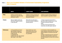
The spreadsheet “Evaluation of Candidate Indicators of Environmental Sustainability of Agriculture” presents the complete list of candidate indicators that were considered in the scoping analysis as well as the results of an assessment that determined the suitability of these candidate indicators...
-
Shipping Activity
This dataset was used as base data in Reefs at Risk. Shipping activity data used in the model of threat to coral reefs from marine-based pollution and damage in the Reefs at Risk Revisited project. This dataset was derived at WRI from the World Meteorological Organization Voluntary Observing...
-
Global Map of Threat of Blast or Poison Fishing
This dataset was used as base data in Reefs at Risk. Map of blast and poison fishing (1 km grid) was developed for use in the Reefs at Risk Revisited project as a component of the model of overfishing and destructive fishing pressure on coral reefs. This layer designates threat of blast and...
-
Bleaching observations (1963-2010)
This dataset was used as base data in Reefs at Risk. Point locations of reported observations of coral bleaching between 1963 and 2010. This dataset was built upon an original bleaching database developed at UNEP-WCMC, and has been maintained and updated regularly by ReefBase since early 2002.
-
Tropical Coral Reefs of the World (500-m resolution grid)
Global map of shallow, tropical coral reefs, gridded at 500-m resolution for use in the Reefs at Risk Revisited project. The coral reef location data were compiled from multiple sources by UNEP-WCMC, the WorldFish Center, and WRI. To standardize these data for the purposes of the Reefs at Risk...
-
Marine Protected Areas in Coral Reef Regions of the World
This dataset is part of the base data used for Reefs at Risk Revisited. To assess the level of protection and management for coral reefs around the world. The map of MPAs and associated management effectiveness scores were used to adjust pressure from overfishing and destructive fishing in the...
-
Reefs at Risk Revisited (Social Vulnerability Data)
This shapefile features the Exclusive Economic Zones (EEZs) for 108 coral reef countries and territories classified according to an index of their reef dependence, adaptive capacity, and social vulnerability. Results are presented as quartiles, with 27 countries/territories classified in each of...
-
Reefs at Risk Revisited: Climate-Related Threats Data
Global (i.e., climate-related) threats to the world's coral reefs were analyzed. These include: past thermal stress (i.e., warming seas and bleaching over the last decade), future thermal stress (ie., projections of future warming in 2030 and 2050); and ocean acidification (i.e., reduced ocean...
-
Reefs at Risk Revisited (Local Threats Data)
Threats from coastal development, marine-based pollution and damage, overfishing and destructive fishing, and watershed-based pollution were analyzed separately. These threats were integrated into the Integrated Local Threat index. Past thermal stress was integrated with local threats into the...
-
Average water consumption of livestock and wildlife by sub-basin in Kenya, 19...
WRI/ILRI calculation based on animal data from DRSRS 2003; Grunblatt et al. 1995, 1996; and daily water requirements for selected species from MoWD and JICA 1992, Peden at al. 2003, 2004. This data was used in Map 3.13 in Nature's Benefits in Kenya: An Atlas of Ecosystems and Human Well-Being.
-
Basins and sub-basins in Kenya
Calculations done by the World Resources Institute. This data was used in selected maps in Nature's Benefits in Kenya: An Atlas of Ecosystems and Human Well-Being.
-
Annual Projected Water Balance by Subdrainage Area in Kenya, 2000 and 2010
Calculations done by the World Resources Institute. This data was used in Map 3.7 in Nature's Benefits in Kenya: An Atlas of Ecosystems and Human Well-Being.
-
Existing small-scale irrigation and drainage points in Kenya
Data compiled by the International Water Management Institute (IWMI), Nairobi, Kenya. This data was used in Map 3.12 in Nature's Benefits in Kenya: An Atlas of Ecosystems and Human Well-Being.
